June 25, 2015 (Day 2 of 3) Bike Ride
I woke up feeling a bit tired from the nearly 400 miles of the previous
day. Actually my first wake up was someone departing the motel at 5 AM.
I'm sure everyone in the place heard them. I don't know why people leaving
then would think to whisper to each other and not run up and down the
metal stars (which attached to a metal railing makes a lot of noise) but
those early risers seem to think it quite acceptable to yell across the
parking lot to their traveling companions. Once this group had departed I
fell asleep again and after a bit more rest ate breakfast and packed up.
My first major stop was La Grande as a fuel stop and also a hunt for a
location to find a decent WiFi connection so as to do some route planning.
The motel had free WiFi but it was not fast enough to be useable. A friend
that helped me with some route planning suggested riding 203, the Medical
Springs Highway. That turned out to be a great suggestion as it was some
of the most beautiful riding on the trip. Rather than take I-84 to the 203
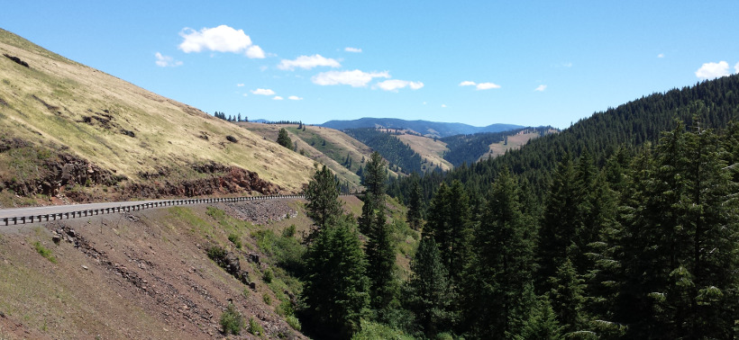
turn off I took Airport Road which very closely parallels I-84. This
deserted road is Airport Road, on the left is I-84.
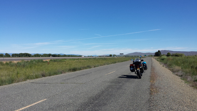
The road has cracks about every 20 feet which makes for a bit of a jarring
ride. Fortunately that does not last long before you turn off on 203.
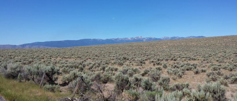
There was very little traffic to be seen on this road. There were signs for
the bicycle race and a few bicycle riders on the road. Lots of big sweeping
turns, some tighter turns from time to time, and beautiful views.
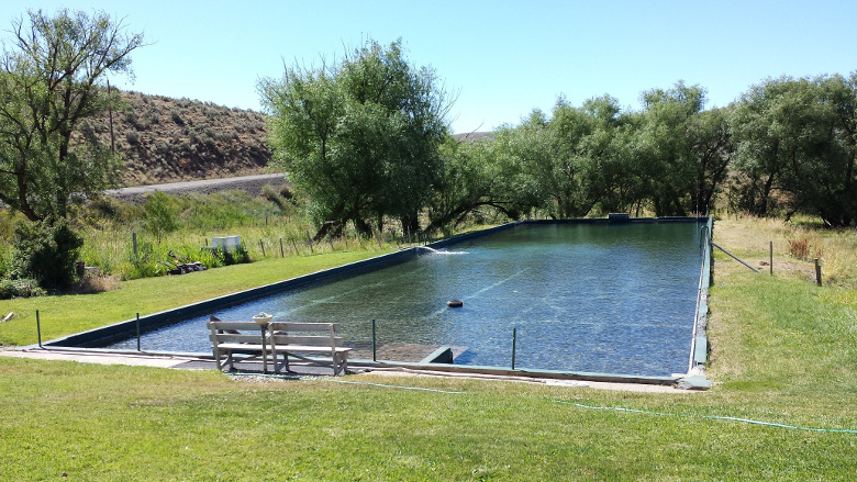
The site of Medical Springs has a pool with nicely trimmed grass around it
and when I was there water flowing into the pool. Not a single person in
sight.
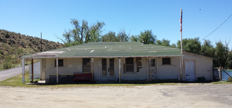
Here are the buildings to be found at Medical Springs.
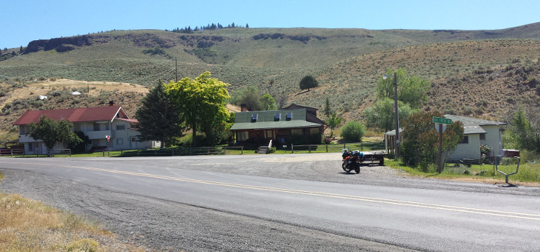
The main building next to the pool does not seem to have been in use for
many years. Still, someone evidently cares enough about the place to fly a
flag.
I stopped at the Safeway in La Grande and got a sandwich at their deli and
made use of their WiFi. That was fast enough to let me use Google maps on my
Chromebook. I made some notes listing the turns and roads for the remainder
of the trip into Lewiston. The Chromebook is a very handy laptop for a trip
such as this. It is one of the more inexpensive Samsung models using flash
memory so no spinning disk drive. So far it has held up well traveling in
one of the side cases on the bike. It allows me to read e-mail and compose
e-mail using a real keyboard and a reasonably sized screen. Google maps is
quite handy for route planning.
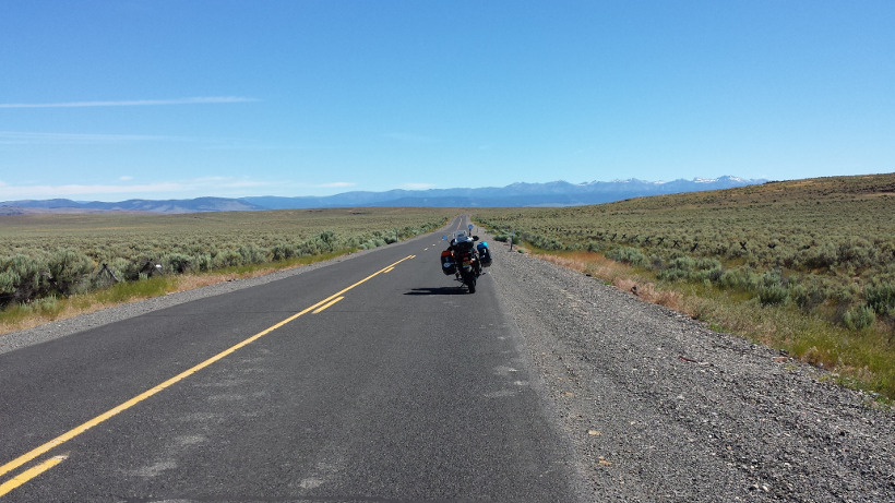
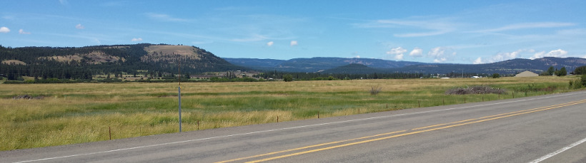
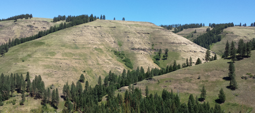
The views from La Grande on into Enterprise continued to be impressive.
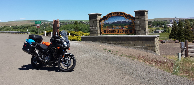
The last major town before reaching Lewiston was Enterprise. I stopped there
for gas and a cold drink.
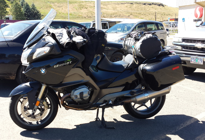
When coming of of Safeway I met a fellow from Wisconsin a couple weeks into
riding his BMW R1200RT. He said he had another BMW at home with over 300,000
miles. His bike had an "Iron Butt" sticker on the back so he is clearly no
stranger to long rides.
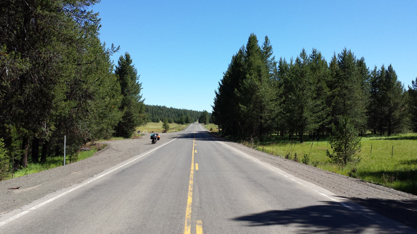
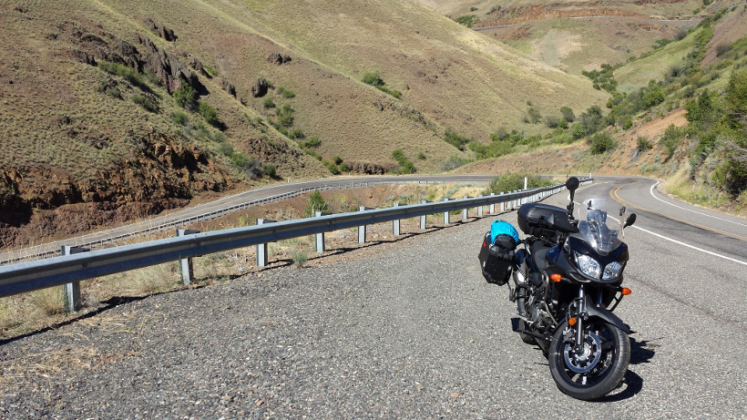
The road out of Enterprise continues to reward with great riding and
beautiful views.
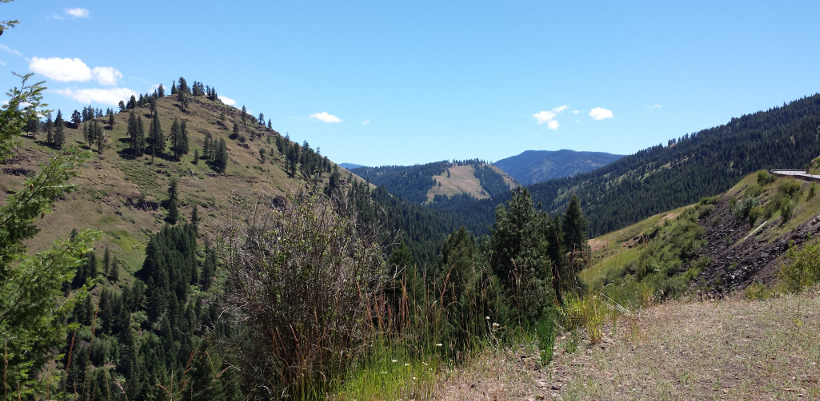
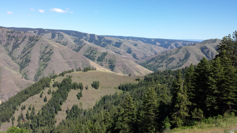
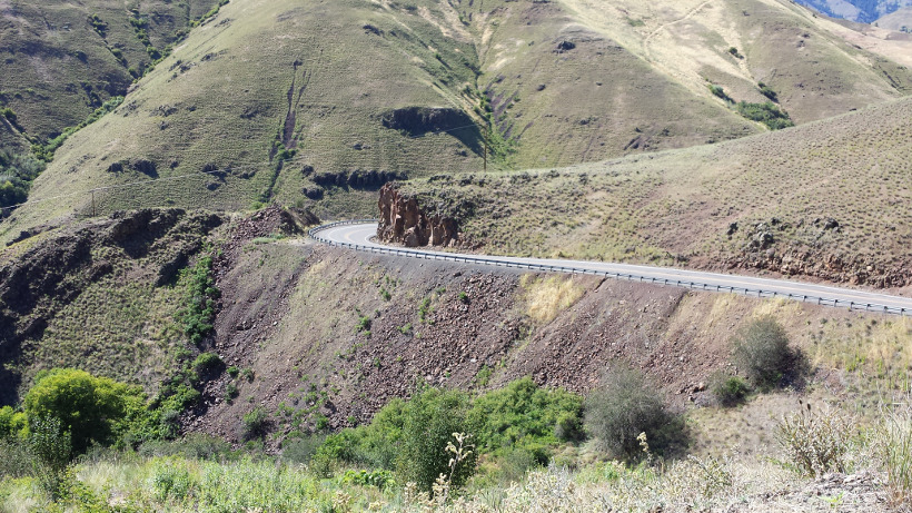
This is Joseph Canyon, the winter home of the Chief Joseph Band of Nez
Perce.
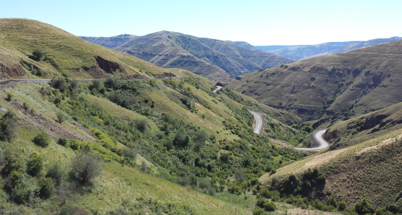
And to all the hard working highway construction crews that built this
section of road between Enterprise, Oregon and Lewiston, Idaho -
motorcyclists everywhere thank you!
Note in the upper right above my bike is another section of the road.
Wow! My riding friends will appreciate this scene.
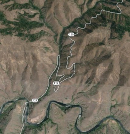
Highway 3 turns into highway 129 as you cross from Oregon to Washington. I
continued on highway 129 into Clarkston,Washington. This is just across the
Snake River from Lewiston, Idaho. There is a long and twisty descent into
Clarkston. This road was in the process of being paved and had a fresh
surface coated with lose gravel and oil in preparation for asphalt arriving.
I took the descent very slowly and stayed in tire tracks to minimize riding
on lose gravel. I had no problems at all with that ride but was extremely
cautious.
I crossed into Lewiston and headed up a hill on the south side of town where
the Clearwater River runs into the Snake River. I stopped at the Inn America
on 21st street. The parking lot did not seem at all full so I was expecting
to have no problem getting a room but found that the place was full. The
person at the desk suggested the Comfort Inn nearby as possibly having a
room and being not too much more expensive. It seems that there was some
event taking place in town that was going to have many places full. I got
directions, put on my gear, and headed off.
I made the turn at the next light as instructed but what I did not know is
that instead of a sign saying "Comfort Inn" all one would see was a small
sign with their logo:
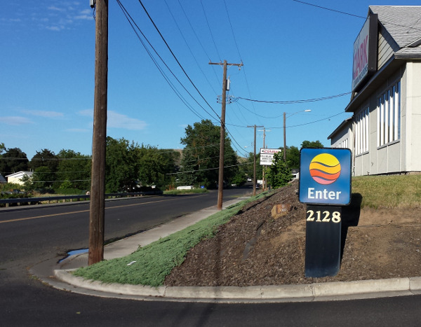
I rode past that and after traveling up the street came back out and
continued up the hill searching for the place. I ended up stopping at a
coffee kiosk and asked for directions. The person working there pointed me
in the exact opposite direction from what eventually proved to be the
correct direction of travel. I did a bit more searching and then stopped,
peeled off my gear, and stood in the 90 degree heat and phoned the Comfort
Inn. They told me that there was only one room left. I told them I wanted it
and got directions. Back I went just a few blocks and having been told that
the sign had only their logo - no name - this time I found my destination.
When I arrived at the front desk they told me that the one remaining room
was a one bedroom suite. The bad news was that it was no going to be as
economical as the previous night's lodging. The good news was that they gave
me 50% discount. The other good news was that the Red Lion next door had an
on-site brew pub "M. J. Barleyhoppers" so I was going to be able to walk to
dinner and enjoy a beer with dinner.
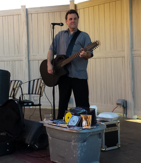
I had some great fish tacos, a salad, a couple nice beers and found that
about the time I finished dinner Jim Basnight of Seattle, Washington was
going to be playing music and singing. I enjoyed his first set, picked up a
few CDs, and headed back to the motel for a soak in the hot tub before bed.
A comment for anyone from the Lewiston highway department. Your
intersections don't spot motorcycles! At the bottom of 21st street we have
this:
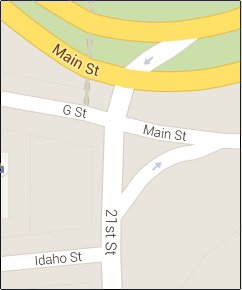
If you are traveling west on Main Street where it turns into G Street and
hoping to turn left on 21st you will never get a green turn light if you are
on a motorcycle. I eventually had to get out of the left turn lane and cross
on a geen then come back on G Street and make a right. And if you are
traveling north on 21st street hoping to make a left on G Street you will
not get a turn signal. On a quiet Sunday morning I ran the red light and
made the turn after making a very careful check for cars.
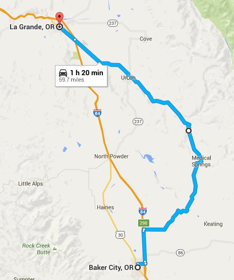
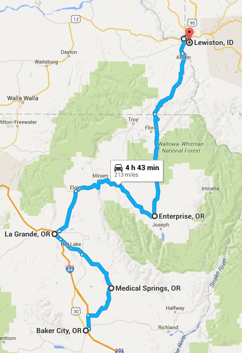
A map of the day's riding:
Link to day 3 ride,
Lewiston to Portland, Oregon.
Back to ride report page.
Back to list of trips and events.