GBES 2006 Rally
On Friday June 17, and Saturday June 18, 2006, the Great Basin &
Eastern Sierra Geocachers (GBES) rally took place. I took part in
this and took some photos. The index page for those photos can be seen here.
The night rally was two or three hours of night desert driving and
finding caches. The day rally was a full day (around 10 AM to 6 PM)
covering around 120 miles of roads, many quite rough. The rally was
held in the area of Carson City Nevada. This is a time/distance rally,
not a race using speed to determine the winner. Instead the winner must
properly navigate a course using a GPS and gain points by arriving at
checkpoints having driven the expected speed and also locate hidden
caches along the way. The home page for GBES is http://gbesgeo.org/ . More rally information can be found on that page.
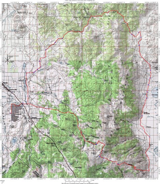
The day rally took us climbing up through Sunrise Pass, leaving the
Carson Vally, over the Pinenuts, and descending into Smith Valley. Here
is an elevation provile for the day rally (thanks to Jim for creating
this):

A small map of the day route appears below. Details become visible in a lager one,
which will require scrolling with your browser in order to view. Note
that at about 3 megabytes the large map takes a while to load. (Thanks
to Jim Washer for creating the map.) Depending on your browser you may
have to click on the image once loaded in order to view it full scale
using scrolling.